Malaspina Forelands Trek

Wow! Time is certainly flying by this summer and its getting faster the older I get!
I’ve been pretty busy for the past few months! Work has been good and I’ve gotten out on several epic adventures. I returned from the most notable trip On July 16th. We did a “survery” along the Malaspina Forelands and covered about 80 miles of coastline. The NPS hasn’t really had anyone cover it all on foot in about 11 years, so I was excited to accomplish the mission and have the opportunity to get out into some of the most pristine wilderness on Earth. I made the trek with Travis, a ranger from Texas, and Pamela, with the Student Conservation Corps. We crossed 13 glacial rivers. 11 of them required the use of pack rafts. River crossings were the most dangerous part, as the water temperature in these glacial streams is just above freezing. Many have icebergs, or “growlers” floating down them, and eventually join the Gulf of Alaska at the river’s mouth. Pack rafts make trips like these much more feasible, but you must avoid the mouths of rivers where frigid waves crash into the silty water flowing straight from the largest piedmont glacier in North America. The Malaspina Glacier covers over 1,500 miles with ice when combined with its two main contributors. Our trip began at Little Esker Stream on the W side of Yakutat Bay and ended at Yana Stream. Yana is the western-most point of the park's coastal boundary, so our trek took us around the Southern half of Malaspina Glacier, along the shoreline. To the South was the Gulf of Alaska and North was the highest coastal mountain range on Earth (St. Elias), the largest piedmont glacier in N.A. (Malaspina), the largest National Park in the U.S. (Wrangell-St. Elias NP), and the largest tidewater glacier in N.A (Hubbard).
I’ve been pretty busy for the past few months! Work has been good and I’ve gotten out on several epic adventures. I returned from the most notable trip On July 16th. We did a “survery” along the Malaspina Forelands and covered about 80 miles of coastline. The NPS hasn’t really had anyone cover it all on foot in about 11 years, so I was excited to accomplish the mission and have the opportunity to get out into some of the most pristine wilderness on Earth. I made the trek with Travis, a ranger from Texas, and Pamela, with the Student Conservation Corps. We crossed 13 glacial rivers. 11 of them required the use of pack rafts. River crossings were the most dangerous part, as the water temperature in these glacial streams is just above freezing. Many have icebergs, or “growlers” floating down them, and eventually join the Gulf of Alaska at the river’s mouth. Pack rafts make trips like these much more feasible, but you must avoid the mouths of rivers where frigid waves crash into the silty water flowing straight from the largest piedmont glacier in North America. The Malaspina Glacier covers over 1,500 miles with ice when combined with its two main contributors. Our trip began at Little Esker Stream on the W side of Yakutat Bay and ended at Yana Stream. Yana is the western-most point of the park's coastal boundary, so our trek took us around the Southern half of Malaspina Glacier, along the shoreline. To the South was the Gulf of Alaska and North was the highest coastal mountain range on Earth (St. Elias), the largest piedmont glacier in N.A. (Malaspina), the largest National Park in the U.S. (Wrangell-St. Elias NP), and the largest tidewater glacier in N.A (Hubbard).
Need I say more?
-Click Map to enlarge.
-Click Map to enlarge.

The beginning of our journey
 Arctic Terns everywhere
 Hubbard Glacier and Lupine

Arctic Tern Chick
These birds migrate further than any other on Earth. From the Arctic, during our summer, to the Antarctic in our winter. Thats a 22,000 mile round trip, in a straight line. The average Arctic Tern travels about 1.5 million miles during it's lifetime of around 20 years.

Terns attacking a Jaeger, or anything else(us) getting near their nest.
 Awwww!!


Ahhh!

Lupine at dusk
 River Otter showing off his dinner. Flounder.

 Bear claw sharpener


This shows you how quickly the shoreline can shift here.

Old wreckage from a barge.

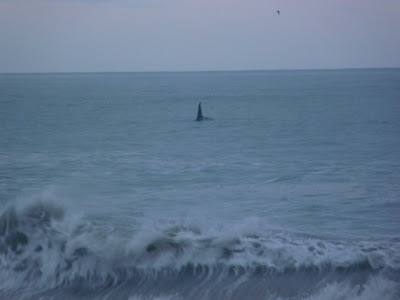
 Large Male Orca
 He's waving to us

 Creep over the bluffs and you see this 18,008 ft giant!

Looking North over Malaspina Glacier to St. Elias


Willowherb

Wild Strawberries. Mmmm!


Arctic Tern, St. Elias
 Where to cross??

Here we go again!

Over with the packs
 Back to get Pamela.

Terns attacking a Jaeger, or anything else(us) getting near their nest.
 Awwww!!
Ahhh!
Lupine at dusk
River Otter showing off his dinner. Flounder.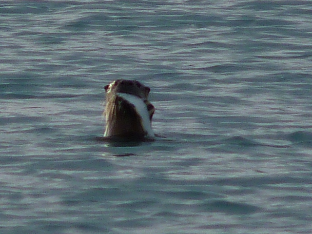
 Bear claw sharpener


This shows you how quickly the shoreline can shift here.

Old wreckage from a barge.

 Large Male Orca
 He's waving to us
 Creep over the bluffs and you see this 18,008 ft giant!
Looking North over Malaspina Glacier to St. Elias


Willowherb

Wild Strawberries. Mmmm!


Arctic Tern, St. Elias
 Where to cross??
Here we go again!

Over with the packs
 Back to get Pamela.
 Having crossed each river 3 times, I logged 37 crossings throughout the entire trip.

This is where you end up if you get swept out to the mouth of these rivers.


This is where you end up if you get swept out to the mouth of these rivers.
Finally!! I found me a glass ball (float). They've been traced back as far as 1840. Fishermen from many different countries around the world used them in their nets. There are still plenty floating around in our oceans. Sometimes they get washed up and found by some lucky fool like me!

Long Day!
 Camp
Camp


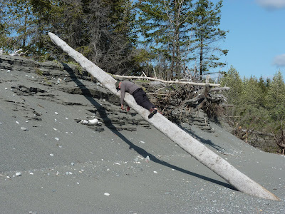
 at it again


Ice fishing...literally.
A keeper!

We broke up the ice and melted it in a dry bag....after we sat and ate it for about 20 minutes like kids in a candy store.


While I was breaking up ice to melt for drinking water, I discovered this pocket of silty water within the ice. There was one little air bubble and even a small rock in the core. It was like nature's Magic 8-Ball.

The forest is actually growing ON the end of Malaspina Glacier. Huge sinkholes cave in as ice melts and icebergs break off the walls into the meltwater. Its like another world on Malaspina!


Long Day!
 Camp
Camp


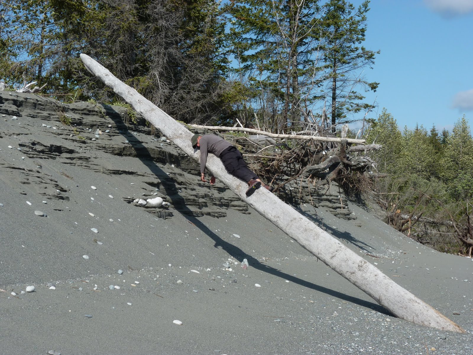
 at it again

After drinking this silty, glacial water for about 4 days, the river literally floated our clean, fresh water right down to us!! Ice!
Ice fishing...literally.

A keeper!
We broke up the ice and melted it in a dry bag....after we sat and ate it for about 20 minutes like kids in a candy store.

Wolf
Bear

While I was breaking up ice to melt for drinking water, I discovered this pocket of silty water within the ice. There was one little air bubble and even a small rock in the core. It was like nature's Magic 8-Ball.

The forest is actually growing ON the end of Malaspina Glacier. Huge sinkholes cave in as ice melts and icebergs break off the walls into the meltwater. Its like another world on Malaspina!

Sitkagi Bluffs.

We started this section at low tide, but by 11 pm the waves were crashing into the rocks and pushing us against the bluffs. It was getting dark, raining, and as the crashing waves pinned us closer and closer to the 50-100ft bluffs on the other side, we had to take refuge. We climbed up the bluff at midnight, started a fire in a ditch, and waited until about 4a.m. By then, the tide had receded and we had room to walk again.
Its much easier to move at low tide.
Our schedules were pretty much set by the tides for much of the trip. 
The last and most difficult crossing; Fountain Stream.
The last and most difficult crossing; Fountain Stream.
We moved upstream about 1/2 mile to allow plenty of crossing time and avoid the mouth. The water temperature changes everything when it comes to crossing these rivers. In warmer waters, getting wet is not such a big deal. Here, it is the main concern, -Hypothermia-. This one was about 250 yards wide. After Sitkagi bluffs, a night in a ditch by the fire, and crossing this river 3 times, I was very happy, but tired and a bit delerious.


It was the largest, swiftest, and scariest because this is where you end up if you don't cross quick enough.

Worn out after a long day, but very happy to be done with the last crossing!

Worn out after a long day, but very happy to be done with the last crossing!

Much deserved rest!

Check out this bear trail. You can make out each footstep in the moss.


Coyote

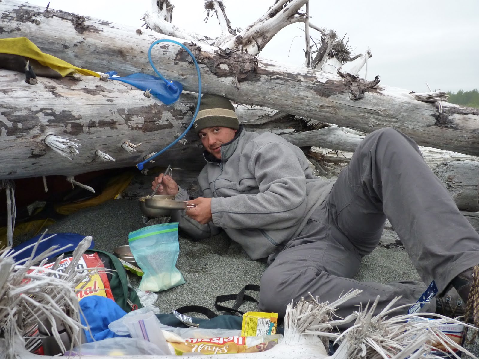
Dinner is always a highlight of the day!


confusing?

shelter

confusing?

We made it!!!
Nice to see Les come into sight 10 days later at our pickup spot, Yana Stream. He's one of the few who really understands the challenge we overcame. Its damn good to know you have a pilot like him on your side!
Over and out!
